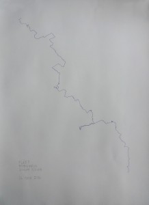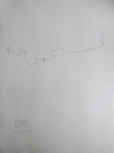
70 miles of walks of the 11 subterranean tributaries of the Thames river in london, using only prior knowledge of the city and a divining rod.
The rivers were forced underground over the previous four centuries in the face of expanding urbanity & there are no accurate maps of their current positions in the city.
A GPS system charted the walks into single lines through empty virtual space.